


Water, the most fundamental and vital element of the Earth’s environment, does not exist only in oceans and rivers. From groundwater to snow, glaciers, and water vapor in the atmosphere, water forms the very environment that surrounds us, and understanding this water is important for fostering coexistence between people and water. Building on the technology developed through water level gauges, Takuwa is also working on the development of technologies to better understand various types of water integrated into the environment.
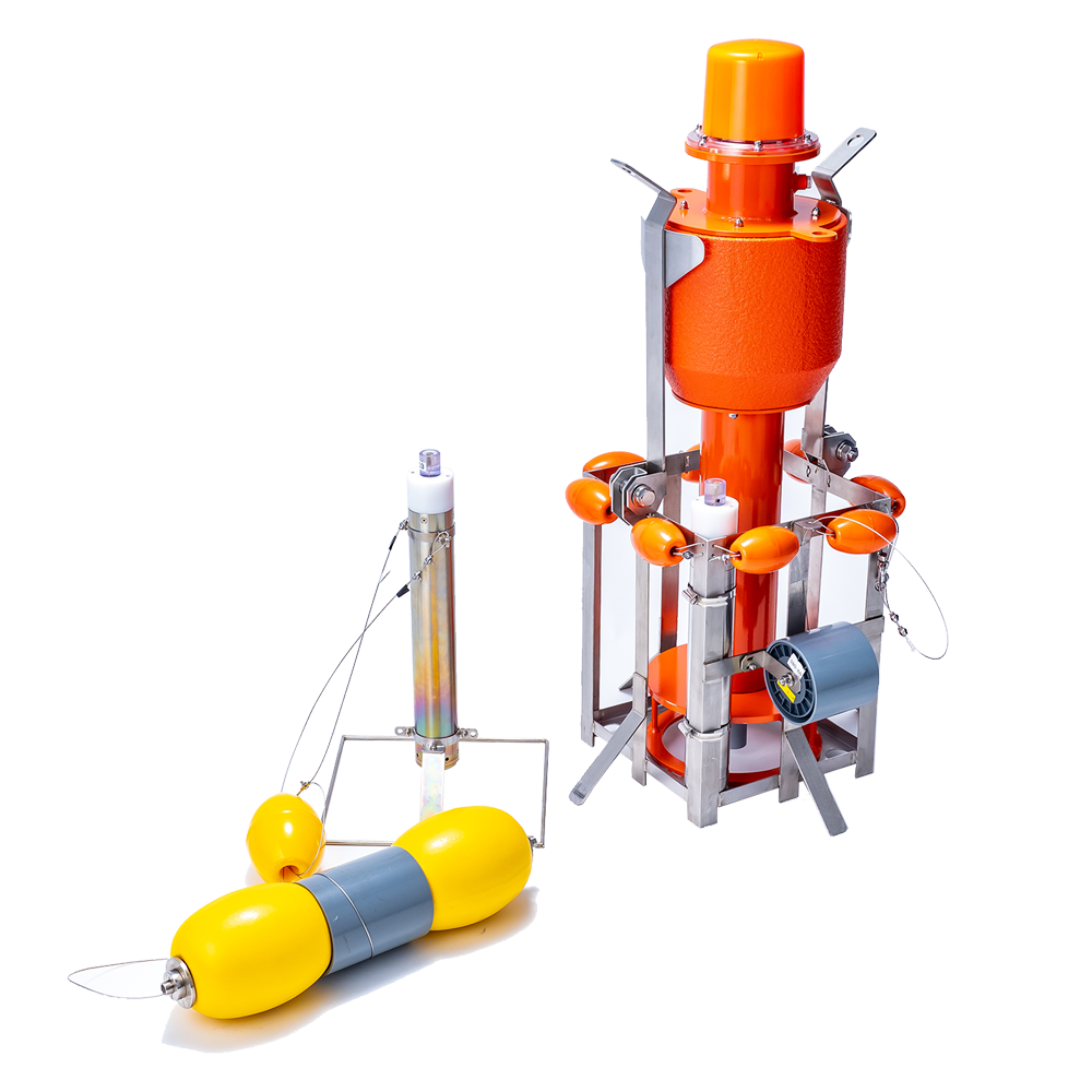
The small water level observation buoys are water level gauges that can be transported and installed by drone or helicopter, enabling measurement of water levels in areas where river channel blockage has occurred due to earthquakes or localized torrential rain, even when access roads are cut off.
They consist of buoys equipped with satellite or cellular communication equipment, and a cage section that includes an anchor to moor the buoys and a pressure sensor with underwater communication functions. The pressure sensor measures the water pressure, and the buoys floating on the water surface transmit observation data (time, location, water pressure converted to water level, atmospheric pressure, and power supply voltage data) to the user’s computer at preset intervals via Iridium satellite or cellular communication, in email format. The observation data, such as water level, is monitored using dedicated receiving software (installation of the receiving software may require permission from the system administrator).
This product is a result of joint research and development between Takuwa and Dr. Yasuyuki Tada, Senior Researcher at the Kansai Research Center of the Forestry and Forest Products Research Institute. It is based on his research on detection method with groundwater aeration sound.
By listening to the sound of groundwater flowing underground, it is now possible to easily detect the locations of water channels* that were previously undetectable.
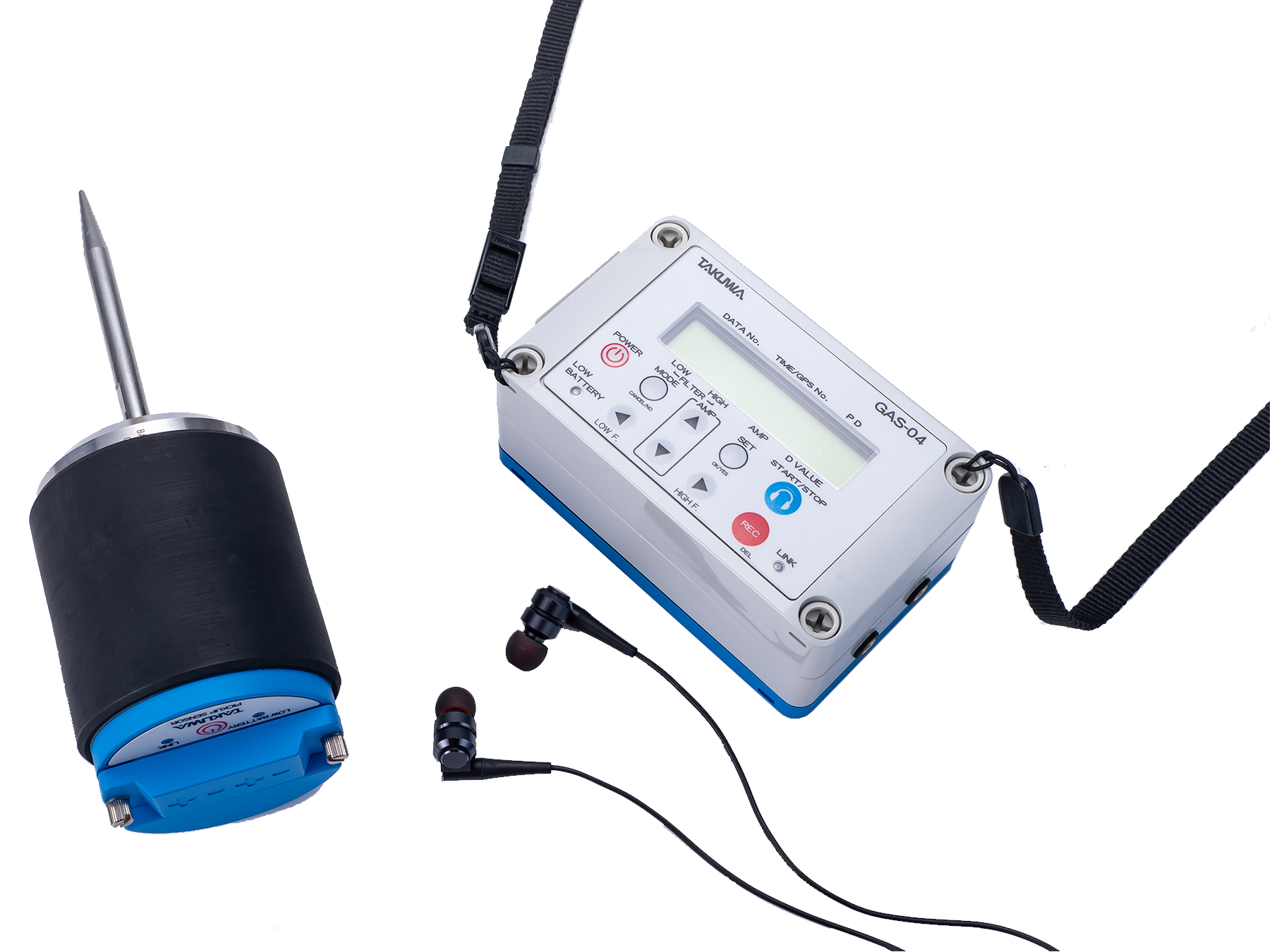
Various sounds exist underground, including the sound of flowing groundwater, the friction of sand and gravel, and the activity of insects. This product uses a noise-cut filter and volume control to reduce various underground noises, allowing it to isolate only the sound of flowing groundwater.
The locations of water channels are identified by leveraging the fact that the sound of flowing groundwater is loudest near the channel itself. This technology is expected to be applied in cases where identifying the location of flowing groundwater is key to solving the problem.The concentrated areas of groundwater
View catalogThe sound source detected by the pickup sensor is transmitted wirelessly to a tablet PC, where signal processing is performed. This allows the intensity of the sound to be judged both audibly and visually through audio output and liquid crystal display (LCD).
The tablet displays not only the representative value of sound intensity at the observation point, but also the frequency characteristics through real-time FFT (Fast Fourier Transformation) processing, along with a map display of the measurement locations.
Various sounds exist underground, from the friction of sand and gravel to the activity of insects. This product reduces various underground noises, allowing it to isolate only the sound of flowing groundwater.
Because the sound of underground water flow is at its maximum near water channels, it is possible to identify paths that were previously undetectable. Therefore, it is expected to be applied in cases where identifying the location of flowing groundwater is key to solving the problem.
View catalog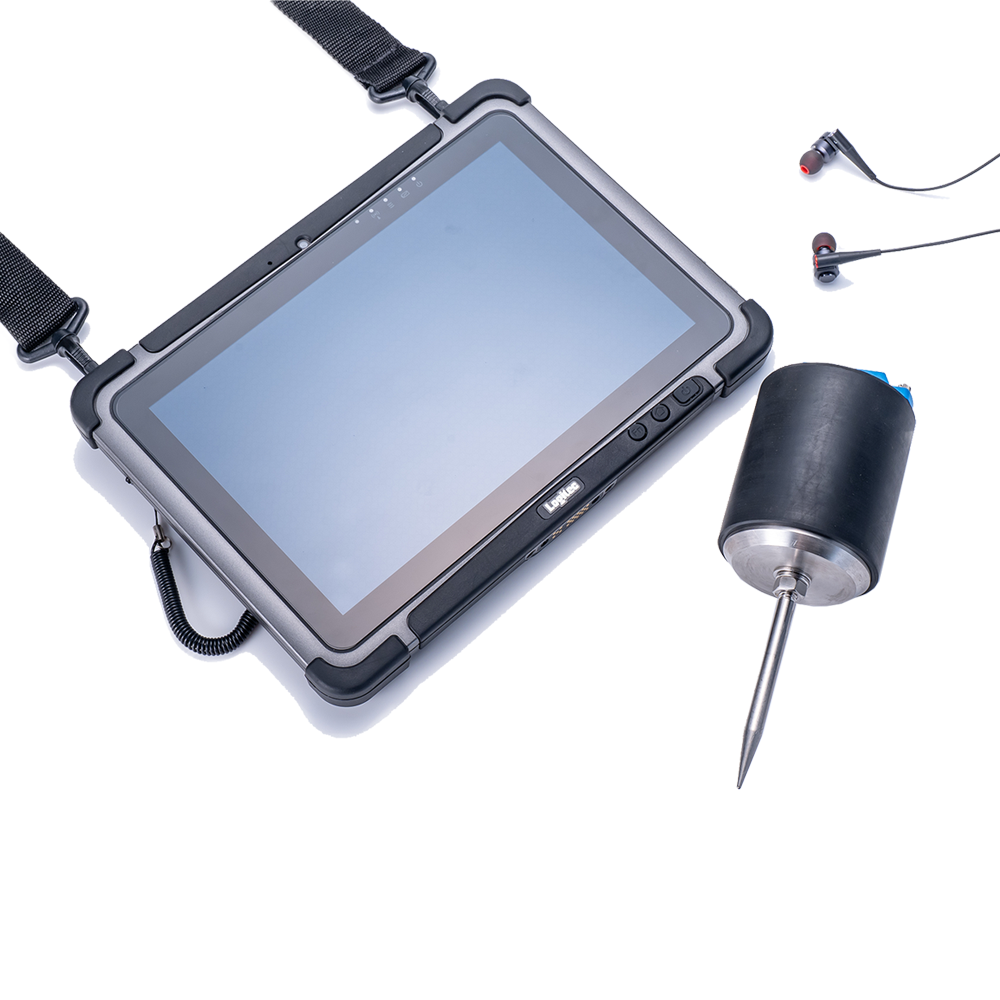
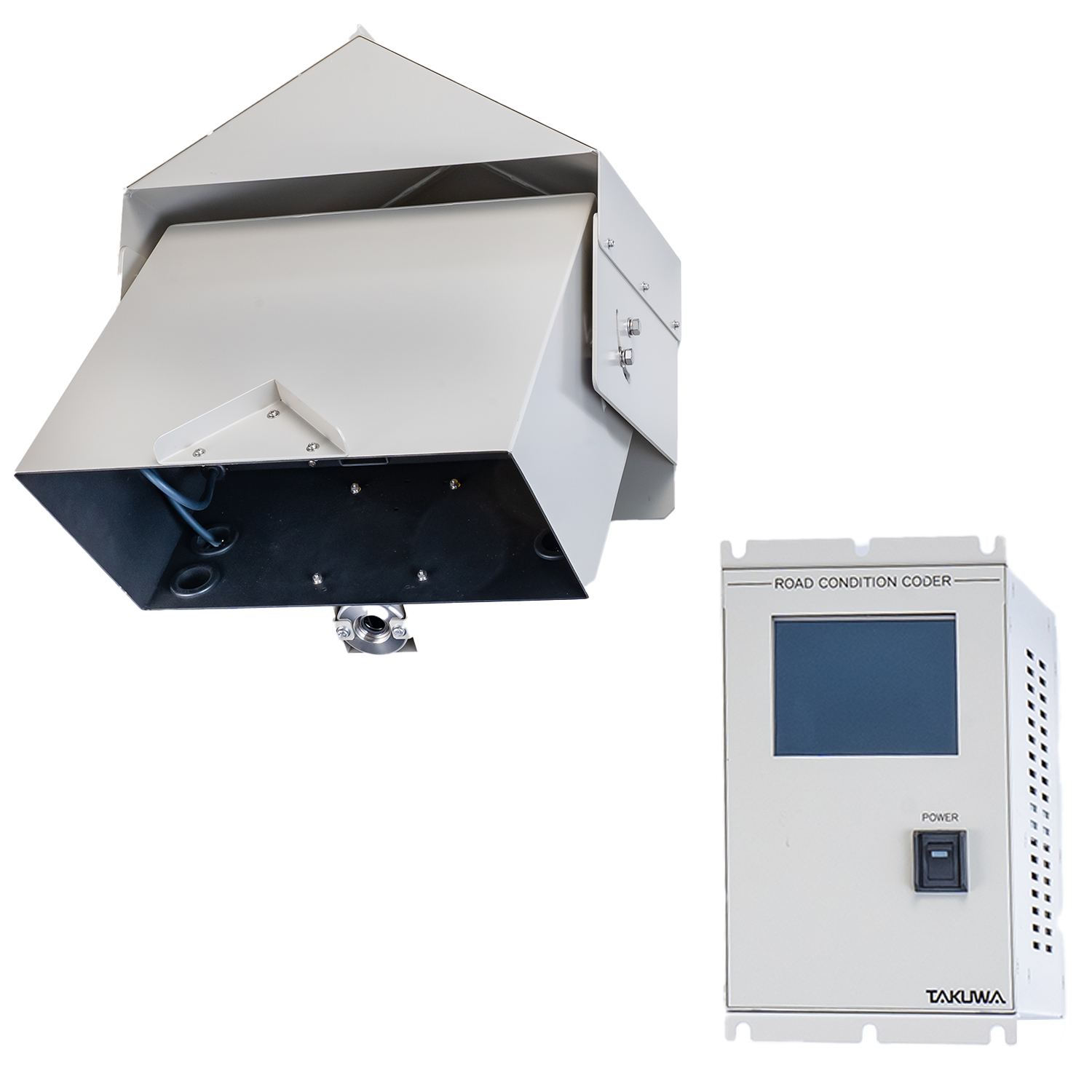
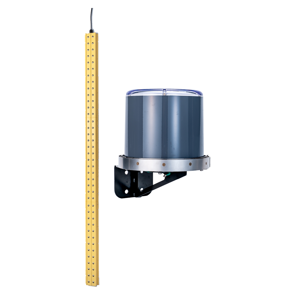
By combining a laser scanning sensor and a radiation thermometer, the road surface height, reflected light intensity, and surface temperature are measured to determine the road surface conditions (freezing, snow-covered, wet, dry, or slushy). It is ideal for managing road surface conditions in heavy snowfall areas and supporting timely snow removal operations.
View catalogThe laser snow depth meter is a device used to measure the snow depth that naturally falls and covers the ground.
Snow depth data is utilized by organizations such as the Japan Meteorological Agency, MLIT (Ministry of Land, Infrastructure, Transport and Tourism), and local governments, who set up observation stations nationwide for snow damage prevention and snow removal planning.
The sensor is installed at a height of approx. 4 to 8.5 meters above the ground, and an infrared ray (IR) laser is emitted from the sensor to the snow surface at a diagonal angle. The laser light hits the snow surface and reflects back to the sensor, which calculates the round trip time and converts it into distance to measure the snow depth.
Unlike conventional ultrasonic sensors, whose ultrasonic waves can be affected by air temperature and wind, lasers are not influenced by these factors, enabling more stable measurements.
View catalog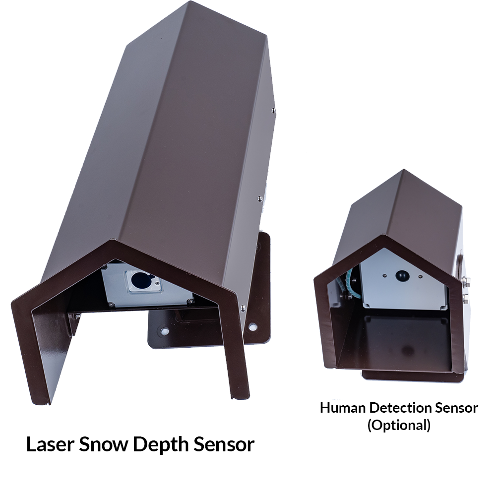
A direct observation type sensor that measures the amount of sediment accumulated at the river bed. It measures the sediment volume based on the properties of the river bed material and the conductivity of the water. The measurement data is output in a sensor-specific signal.
View catalogIf you would like to know more about any of our products or services, please do not hesitate to contact us.
You can use the inquiry form on this site or contact us by telephone.